-
 Digital Download - 1 image
 -
 Dimensions 3424 x 5760 pixels


1
/
of
2
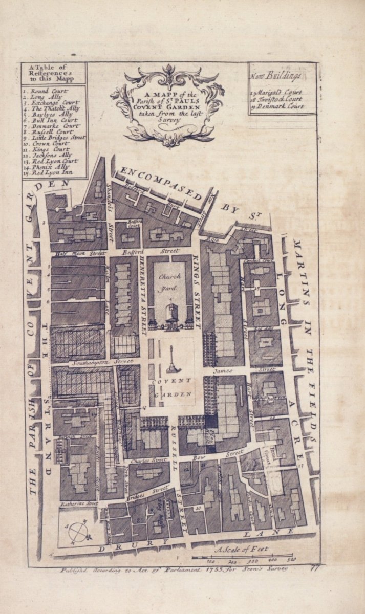
A Map of the Parish of St. Paul's, Covent Garden from John Stow's Survey of London 1755.
A Map of the Parish of St. Paul's, Covent Garden from John Stow's Survey of London 1755.
Digital Download - 1 image
Regular price
£0.80
Regular price
Sale price
£0.80
Unit price
/
per
Tax included.
Couldn't load pickup availability
No reviews
- All images are out of copyright
- Commercial use allowed
- Immediate download after purchase
A map of the parish of St. Paul's, Covent Garden, London, from John Stow's Survey of London 1755.
This download consists of 1 image, in JPEG format, that is 600dpi and 3424 pixels wide by 5760 pixels tall.
The picture is out of copyright and in the public domain, so you are free to use it in whatever way you'd like, including commercial use.


Public Domain Copyright Rules
The pictures in our collections are out of copyright in the United States, the UK, Canada, most of Europe, Australia and all countries that follow the lifetime plus 70 years rule. Read our blog post about public domain copyright rules for more information.